Brazil’s Mangrove Forests Represent Untapped Blue Carbon Banks, Says New Study from National Geographic Explorers
Press Release
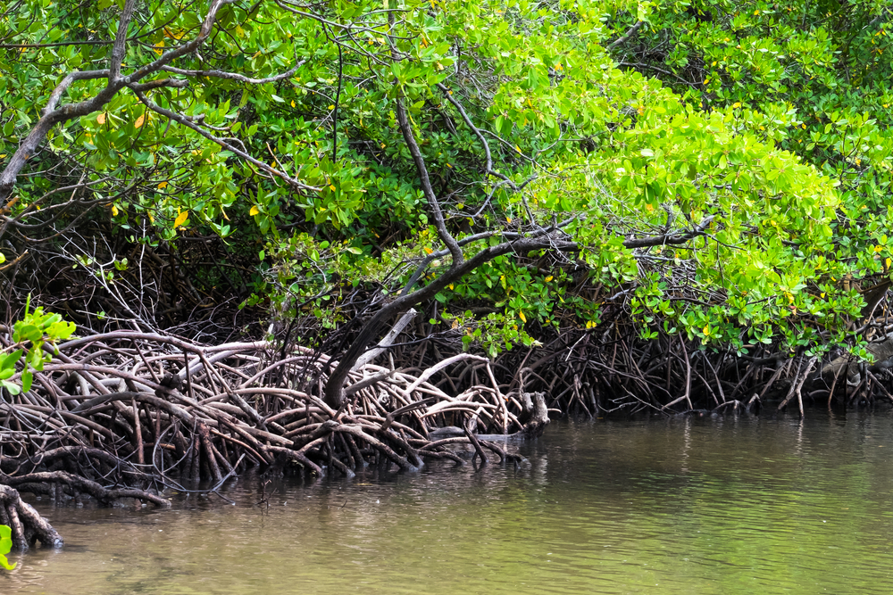
Washington, D.C. (March 4) — Released today in Nature Communications, a new study titled “The inclusion of Amazon mangroves in Brazil’s REDD+ program” suggests that Brazil’s mangroves hold untapped climate mitigation potential, sequestering an estimated 468.3 tonnes of carbon per hectare — a capacity roughly 3-20-fold higher than that of Brazilian upland biomes. The study, authored in part by National Geographic Explorers Angelo Bernardino and Margaret Awuor Owuor, proposes that it is essential that Brazil’s mangroves be included in the country’s Nationally Determined Contributions (NDCs) as part of the Paris Agreement and could be further utilized in the voluntary carbon credit system to finance forest conservation through the REDD+ initiative.
Protecting these blue carbon reservoirs would not only be key to helping Brazil reach its 100 percent emissions reduction goal, but could also provide added economic benefit as actions to halt mangrove loss in the Amazon could potentially generate nearly 11.5 ± 0.11 million tonnes in carbon credits over a 10-yr period (2020-2030) under REDD+, suggesting they are of great value to mitigate emissions from the forestry sector and finance biodiversity conservation.
Brazil contains the second largest repository of mangrove forests in the world, yet the country’s National REDD+ strategy currently does not include the mitigation of mangrove deforestation in the context of result-based payments for reducing emissions under the United Nations Framework Convention on Climate Change (UNFCCC). To better understand their potential impact and advocate for these critical coastal ecosystems, Bernardino, Awuor Owuor and a team of local researchers analyzed 900 soil samples and tree measurements from over 190 forest plots to determine mangrove forest emission levels across pristine and deforested areas near the Amazon River mouth including Sucuriju, Araguari and Bailique, and to the east including Curuçá, Maracanã and Bragança.